Our final exam is scheduled for 5 pm Monday, May 4. We will need to present our project in PowerPoint to the class, and turn in a written report and CD with our work on it.
I finally have georeferenced historic maps, and I'm concentrating on the Foster/Centerville 15 minute quad. I'm busy making polygon layers showing the sandbar growth. The shorelines are changing too; so I am going to try to do a shoreline layer representing 1935, 1940, etc.
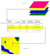
The geomorphology is more interesting to me at this point than the cultural emphasis that I started with. After tracing so many lobes and mittens of the delta, I'm beginning to be fascinated by the stages of its formation. I am doing a new layer for each point in time, which will have the additional feature of being able to approximate the area of the delta in each time period.
Subscribe to:
Post Comments (Atom)


No comments:
Post a Comment