I received my student edition of ArcGIS 9.3 last week, got it all installed. I was hoping the new version would make some difference with my troublesome Foster quads. However, I had the same results when attempting to georeference. The Foster quads want to be 1/2 degree off, even when the map frame has the correct projection.
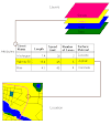
My hope of mosaicking the historic quads is over; now I have to figure out how to tell the story with the independent quads.
It's wonderful to have the software at home. I wish I had dual monitors like the lab because it's also handy to have ArcCatalog open in one monitor and ArcMap open in another.
Sunday, March 29, 2009
Wednesday, March 25, 2009
On the Verge of an Epic Fail
This may be an exaggeration, but I'm pretty bummed right now. The semester is more than half over and my favorite base maps are still misbehaving.
I can georeference the other historic 15 minute maps, but not the Foster quad. I think it's a projection error. However, the map collar info on the Foster quads looks the same as the Chicot and Loreauville quads that I've successfully georeferenced. But none of the projections that work with Chicot and Loreauville will work with Foster. The Foster quads are all 1/2 degree off, and squish vertically when 3 coordinates are entered with the georeferencing tool.
The Foster quad shows the sand bar growth over time in Grand Lake, and is the most dramatic of the maps.
I have ordered a student version of the software so I can work at home; I need to be able to work on this on weekends, not just in available lab hours.
Saturday, March 21, 2009
How I've Done So Far
Ok. I have done two project proposals this semester. The first one fell through due to lack of geographic data. It might work in another year if the samples are identified geographically.
I have another one, less spatial analysis possible but more descriptive. I have many text files to read to gather the spatial data from. This project has potential to be a cultural history map.
I have scanned 15 minute maps, from the mid-1930s to the mid-1970s. I might be missing one or two from the study area, need to see about getting them.
I was successful in georeferencing one of the maps two weeks ago at the end of lab time, thought I was home free. Worked last lab at georeferencing the rest, but it didn't work. They were all half a degree off; when I put in correct coordinates the map would distort, squished together sideways. It looked OK if I put the wrong coordinates. I fooled around with the projection properties in the data frame because the distortion looked like a projection error to me. Could not find a projection that would remove the distortion.
So far, have not found a reason for this happening, have not found any more information on possible reason/solution on ESRI web site yet. Need to find a forum.
Other steps - need to contact DEQ source for historic maps, see if I can copy the Atchafalaya maps onto a portable hard drive. A little bird told me source is going to retire this spring, need to move fast.
Friday, March 20, 2009
Why???
Because I'd like a record of my progress. I'm taking the second GIS class in a series, and running up against some roadblocks.
I'm creating this as a place to vent, and also to record my triumphs.
I'm creating this as a place to vent, and also to record my triumphs.
Subscribe to:
Posts (Atom)