This may be an exaggeration, but I'm pretty bummed right now. The semester is more than half over and my favorite base maps are still misbehaving.
I can georeference the other historic 15 minute maps, but not the Foster quad. I think it's a projection error. However, the map collar info on the Foster quads looks the same as the Chicot and Loreauville quads that I've successfully georeferenced. But none of the projections that work with Chicot and Loreauville will work with Foster. The Foster quads are all 1/2 degree off, and squish vertically when 3 coordinates are entered with the georeferencing tool.
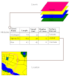
The Foster quad shows the sand bar growth over time in Grand Lake, and is the most dramatic of the maps.
I have ordered a student version of the software so I can work at home; I need to be able to work on this on weekends, not just in available lab hours.
Subscribe to:
Post Comments (Atom)
No comments:
Post a Comment