
Monday, April 27, 2009


Sunday, April 26, 2009

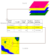
Results of Polygon Creation Efforts
Here is a draft; I'm still working on the polygons, the shorelines, and need to put map information text. Still very unfinished but it might work.


Friday, April 24, 2009
Still Creating Polygons
My polygon layers represent the growth of the sandbars in Grand Lake between 1935 and 1973. I have over 500 objects in three layers. I'm about to start on another sandbar; the largest. It should be between 250 and 300 objects.
Also have point layers showing individual locations at different points in time, and some shoreline layers.
Also have point layers showing individual locations at different points in time, and some shoreline layers.
Wednesday, April 22, 2009
Nothing Like Digitizing First Thing in the Morning
Added a few polygons to my sandbar layer while drinking coffee. Now I have to hurry and get ready to go to the office.
Tried to interest the teenage daughter in the project last night; thought she could get interested in doing some polygons. Attempted a Tom Sawyer-like psychology maneuver but daughter saw through it, pronounced the polygon digitizing activity "tedious."
Well, it can be. I choose to think of it in a more zen-like manner, and absorb the beauty of the landforms. While I try to suppress the muscle spasms in my neck.
Tuesday, April 21, 2009
The End is in Sight
Our final exam is scheduled for 5 pm Monday, May 4. We will need to present our project in PowerPoint to the class, and turn in a written report and CD with our work on it.
I finally have georeferenced historic maps, and I'm concentrating on the Foster/Centerville 15 minute quad. I'm busy making polygon layers showing the sandbar growth. The shorelines are changing too; so I am going to try to do a shoreline layer representing 1935, 1940, etc.
The geomorphology is more interesting to me at this point than the cultural emphasis that I started with. After tracing so many lobes and mittens of the delta, I'm beginning to be fascinated by the stages of its formation. I am doing a new layer for each point in time, which will have the additional feature of being able to approximate the area of the delta in each time period.
Sunday, April 19, 2009
Trying to Make Progress on Final Project
Now I have the maps from DEQ - about 90 of them. I separated the 15 minute and 7.5 minute ones in separate folders. Looks like I won't be able to trim the map collars and make them stay georeferenced. They don't mosaic well but I need to start creating my feature classes anyway.
I planned to spend the whole weekend working on it but other matters have come up. Hope to have some time this evening. The original project will not be completed, but I hope to show progress. Jim Delahoussaye is still working on the book that my project will illustrate/complement.
I've about decided to complete showing the sand bar growth in Grand Lake as the major part that will be completed during this class.
One of the presenters at the conference said, in passing, that she had a set of maps for Grand Lake so I need to find her e-mail, see what she has. Can't wait for it though, have to soldier on with what I have now.
Tuesday, April 14, 2009
25th Annual Remote Sensing & GIS Conference
The conference kicked off this morning in the new conference center on LSU campus. Beautiful space, very nice people. Heard some very interesting presentations this morning. I'm going to use a few phrases I heard in my final presentation. You ready? Here they are... "hydrologic regime" and "multi-temporal analysis."
I got to meet Joe Holmes, newly retired from DEQ, who was the source of maps for my project this semester. Met others from the USGS in Lafayette, also people from Lincoln Parish.
Time to get back... lunch about over.
I got to meet Joe Holmes, newly retired from DEQ, who was the source of maps for my project this semester. Met others from the USGS in Lafayette, also people from Lincoln Parish.
Time to get back... lunch about over.
Monday, April 13, 2009
Georeferencing workshop
I georeferenced a street map of LSU to a raster screen shot mosaicked in Photoshop. I got RMS down to 1.8. Very nice map.
Very good presentation, learned a lot. It's possible to use building layer as well as street layer to georeference. Now I know what I was missing by relying on the ArcMap help screens.
Very good presentation, learned a lot. It's possible to use building layer as well as street layer to georeference. Now I know what I was missing by relying on the ArcMap help screens.
Monday morning in Baton Rouge
Drove through the fog this morning to attend a georectification workshop preliminary to the LARSGIS conference this week. Waiting for latecomers to arrive. Hope to gain mental illumination on the topics I've been struggling with this semester for my class project using historic maps.
Friday, April 10, 2009
Maps Galore
Jim brought by the external hard drive that he copied 90 area maps from DEQ. I can't wait to have time to look them over.
Tuesday, April 7, 2009
New Stuff!
I got some new tiffs today from Joe Holmes at DEQ - they are georeferenced historic 15 minute quads in my study area. They are referenced to NAD83. I haven't tried to create my feature layers yet with them, but I downloaded, unzipped and looked at them in ArcMap. I am regaining hope for the project. Meanwhile, during lab yesterday, I downloaded some modern maps that I was going to try to create polygon layers showing the shoreline changes and sandbar development.
I'm going to go forward with the maps Joe sent me. My cohort in crime, Jim Delahoussaye, will go to Joe's office tomorrow with an external hard drive to copy all the historic maps that Joe has on the Atchafalaya Basin area.
I'm going to go forward with the maps Joe sent me. My cohort in crime, Jim Delahoussaye, will go to Joe's office tomorrow with an external hard drive to copy all the historic maps that Joe has on the Atchafalaya Basin area.
Saturday, April 4, 2009
Answers on the Horizon
I met John Snead, Cartographic Manager at the Louisiana Geological Survey at the cochon de lait we attended today. I mentioned my problems with the 15 minute historic quads, and he told me that the answer lies in the properties of the projection. Specifically, the meridian, lat/lon and other properties. I need my projection to match.
He suggested that there may be metadata available on the maps, which would be contain the information I'm looking for.
I'm going to e-mail Joe Holmes at DEQ to see if metadata exists on these maps.
He suggested that there may be metadata available on the maps, which would be contain the information I'm looking for.
I'm going to e-mail Joe Holmes at DEQ to see if metadata exists on these maps.
Friday, April 3, 2009
All Set for Rectifying Rasters Pre-Conf Session
I have signed up for the pre-conference session on rectifying rasters. It is only a morning session, but I hope to at least find out why my 15-minute quads won't work.
Wednesday, April 1, 2009
GIS Woes Continue
This is not an April Fools joke - I have to figure out how to complete the project without my favorite maps. Time's a-wastin'. I also need to finish all the reading to find the locations for my features.
Why do the 7.5 minute old maps georeference fine, but not the 15-minute ones? Still reading up on ESRI web site support and knowledgebase as much as time allows; haven't found answer. Bryan, the lab instructor, has my files and is giving it a try.
Looking forward to the Remote Sensing and GIS workshop in Baton Rouge the week after Easter.
Subscribe to:
Posts (Atom)