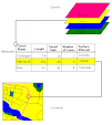
I received the 2009 imagery from the Alexandria, LA NRCS office on Monday, October 26 and have been working with it ever since. The imagery includes all of Vermilion Parish, so I've trimmed it down to the Coulee Baton watershed, including the downstream part of Coulee Baton that is not part of the microwatershed project.
The land use polygons have to be created manually by hand, and I've started on the human habitation polygons. I still need to touch base with the Abbeville Farm Service office for current crop data.
I have the 2006 maps on one screen, and the 2009 imagery on the other - the apparent human habitation is much more dense on the 2009 than on the 2006.
Subscribe to:
Post Comments (Atom)


No comments:
Post a Comment