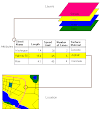
Now I have the maps from DEQ - about 90 of them. I separated the 15 minute and 7.5 minute ones in separate folders. Looks like I won't be able to trim the map collars and make them stay georeferenced. They don't mosaic well but I need to start creating my feature classes anyway.
I planned to spend the whole weekend working on it but other matters have come up. Hope to have some time this evening. The original project will not be completed, but I hope to show progress. Jim Delahoussaye is still working on the book that my project will illustrate/complement.
I've about decided to complete showing the sand bar growth in Grand Lake as the major part that will be completed during this class.
One of the presenters at the conference said, in passing, that she had a set of maps for Grand Lake so I need to find her e-mail, see what she has. Can't wait for it though, have to soldier on with what I have now.
Subscribe to:
Post Comments (Atom)


No comments:
Post a Comment