Tuesday, July 26, 2011

Esri UC 2011


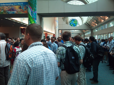
Attended the Esri International User Conference in San Diego July 10-15. It was awesome. Production values very high. It was like a theme park for geographic information systems. There were about 30 tracks, including technical workshops and paper sessions, plus short demos on the exhibit floor.
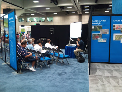

Oh, and did I mention the technical support staff that would sit down with you one-on-one and solve your problems? There was also an area where you could sit down and do a 20-minute hands-on training session.

I made some new contacts and learned the bits I was missing during the technical workshops.

The social event was a food, music and museum night at Balboa Park, where most of the museums were open for us alone. Had a great time at the San Diego Art Museum, and loved the jazz ensemble at the open air theater.
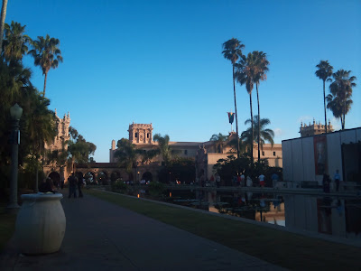


I was staying at a hotel just down the street from the conference center, and walked down the sidewalk by the harbor each day to get there. The conference center is built a little like a cruise ship - decks on every side, and glass walls and ceilings.
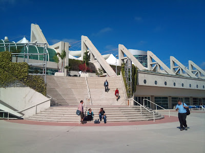
The temperature was between 62 and 72 the whole time I was there, which was a great vacation from the near 100's I left at home. The hot tub jets at the hotel massaged my aching feet every night, and made it possible for me to walk miles again the next day. I could attend this conference every year, and never get tired of it.

Tuesday, June 21, 2011

Fast Forward

OK,
I got too busy to keep up with this. After the last post, I took a Remote Sensing class, made an A, and also the Capstone Seminar. Made all A's in the classes.

My fancy report covers and matching CD labels paid off, and my instructors recommended me for a GIS position in local government about a year and a half ago.

Sooo, not only did I finish the GIS Certificate program, but started a career as well. I'm busy building the GIS department from scratch, getting government departments cooperating to create an enterprise GIS. Work is progressing on foundation layers, and also on ArcGIS Server stuff like map services, and simple web applications. Still can't figure out the best way to serve my 6" aerial imagery - map cache? Server image extension? Maybe I'll find out at the ESRI user conference this July.

Also have to get server permissions fixed so that departments outside our domain can sign in and see everything.

Having lots of fun with it, lots of variety because I'm doing work for many different departments.

Friday, November 27, 2009

Down to the Wire

It's the last week of classes - then the final presentation. I have lots of writing to do on my paper, and lots of organizing files for Dr. Poudel.

So much work, so little time. However, some of the outstanding questions about the NEDs I was working with have been answered.

Saturday, October 31, 2009

2009 Imagery!

I received the 2009 imagery from the Alexandria, LA NRCS office on Monday, October 26 and have been working with it ever since. The imagery includes all of Vermilion Parish, so I've trimmed it down to the Coulee Baton watershed, including the downstream part of Coulee Baton that is not part of the microwatershed project.

The land use polygons have to be created manually by hand, and I've started on the human habitation polygons. I still need to touch base with the Abbeville Farm Service office for current crop data.

I have the 2006 maps on one screen, and the 2009 imagery on the other - the apparent human habitation is much more dense on the 2009 than on the 2006.

Friday, October 23, 2009

Beautiful Images


It's easy to lose time staring at the beautiful images created by the ancient meanders - wish I knew more about the geomorphology. I only remember the basics of it from historical geology.

More Watershed Analysis

I have downloaded 3-meter resolution NED files from the USDA Geospatial Data Gateway. I have mosaicked the ones from my study area, and extracted a smaller area of the mosaic using a mask.

I have run the hydrology tools on this NED, and have had much better results than with the first DEMs (10 meter resolution). I want to run them using pour points instead of the area-wide tools I've been using, see how those results compare with my current results.

My main problem is, the textbook I'm using doesn't go into as much depth as I'd like on this subject. It references other works, but so far I haven't gotten my hands on them. I have questions regarding the accuracy of the watershed analysis tools. My watersheds almost, but not quite, agree with the hydrology unit layer I've downloaded from the USDA website. I've downloaded both the 8- and 12- digit layers. What do GIS analysts do when confronted with this kind of conflict?

I've been spending all my time on the watershed analysis tools, and I need to get busy with the basics - land use, etc.

Bob Capezza is supposed to send me the 2009 NAIP files for Vermilion Parish via DVD. I've downloaded the 2007 layer, which is the latest available on the USDA web site.

I need to contact the Abbeville NRCS and Farm Service people on the land use data because previous GIS information on Coulee Baton was lost in a computer crash.

Tuesday, October 6, 2009

Not Thrilled with Results of Watershed Tool

I ran some tools on my mosaicked DEM, got some good preliminary results, but the result of the watershed tool was a value of 1, which gives a map that is one solid color. That's not what you want.

I need to re-run some of the preparatory tools again with different values, see if I come up with any new results. I might not, because the D8 algorithm in ArcMap is fast and efficient of computer resources, but is known to work much better on areas with more relief than I have in my very flat watershed.